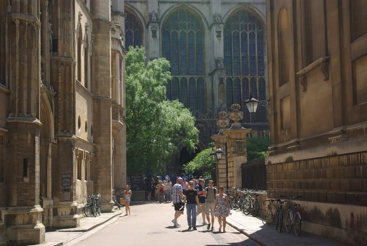
Location guide · Confirmed production city; individual shots vary

Cambridge: the wider story city

Cambridge · multiple exterior locations

Reviewed 8 October 2026 · Sources & corrections
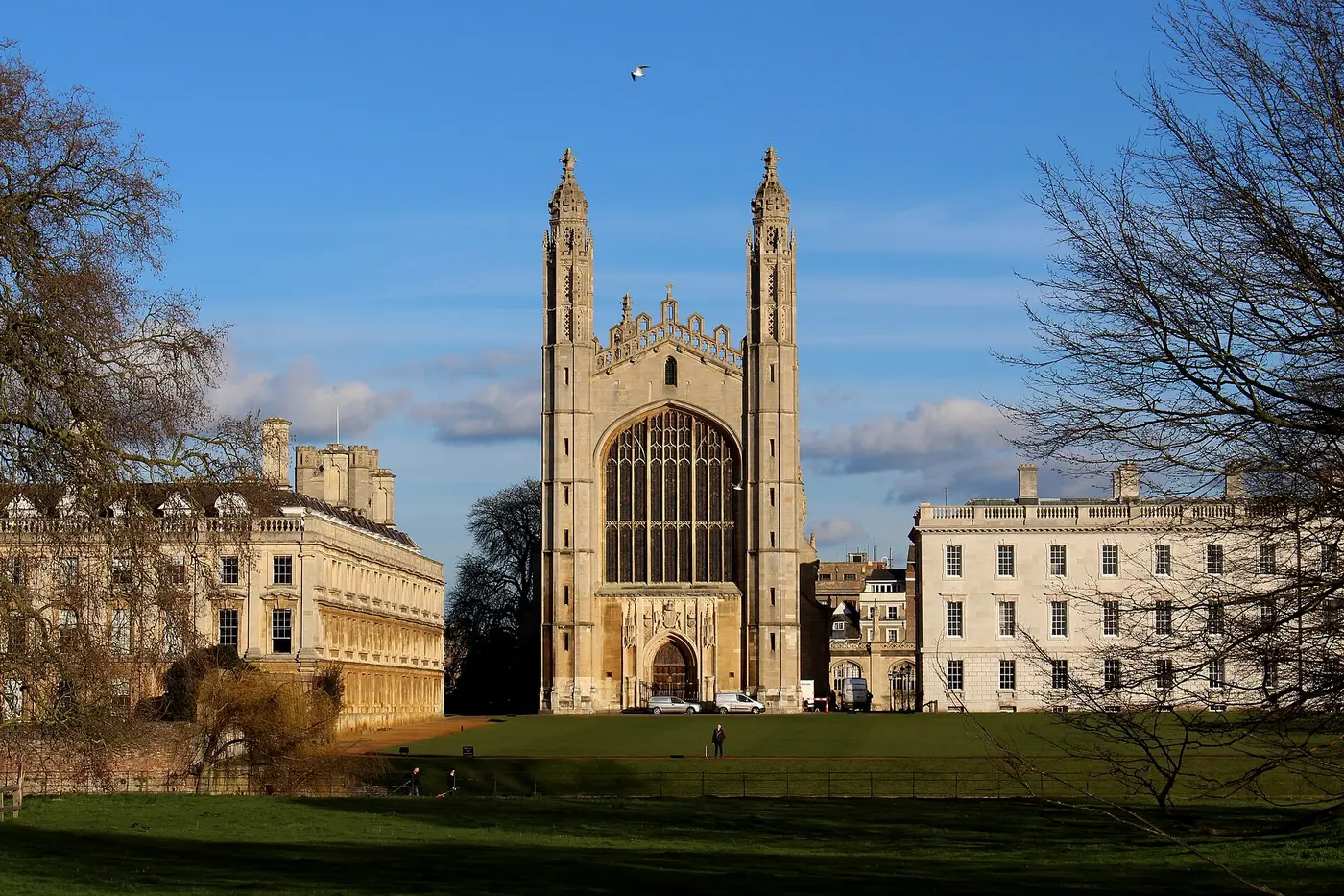
King’s College Chapel seen across the riverside grounds known as The Backs in Cambridge
King’s College Chapel from The Backs, photographed 18 February 2016. Photo: DomWestcliff / Wikimedia Commons file record · CC BY-SA 4.0.
History and background

The place before the programme

Cambridge developed around a River Cam crossing known from at least the ninth century. The University’s scholars were present by the early thirteenth century, and the city’s streets now combine medieval routes, college courts, Victorian expansion and modern academic buildings. That layered townscape is central to the programme’s identity.
Ludwig production file

How it appears on screen

Ludwig uses Cambridge as a story world and as a source of establishing exteriors, but editing joins genuine Cambridge views to interiors and stand-ins filmed elsewhere. This page is therefore an overview, not a claim that one continuous on-screen journey can be followed on foot.

Responsible access

Before visiting

This is a city-wide guide, not one ticketed venue. The photographed Backs, the River Cam, public streets and individual colleges have different access rules. Use the dedicated river and Backs visitor guide for council paths, college restrictions, punting and real photographs. Start with public routes; do not assume that a filmed court, workplace or residence is open.

  • Public starting point: The Tourist Information Centre is in the Guildhall, 11 Peas Hill, CB2 3PP. It lists daily opening 10am–4pm, in-person route advice, tour booking and luggage storage. This is a planning point, not a claim that filming occurred there.
  • Opening, booking and cost: Public streets have no admission ticket. College grounds and attractions set their own opening, booking and charges. The Trinity College visitor page, for example, says its section of The Backs is normally accessible 9am–5pm but may close for events; check with its porters before travelling. Do not generalise Trinity’s rules to other colleges.
  • See the river: The City Council lists six licensed punt stations, including Quayside, Mill Pond on Silver Street and Mill Lane. Buy from a licensed operator; tour prices, availability and boarding accessibility must be checked with that operator. A punt ticket is not college admission.
  • Train and local travel: Cambridge City Council places Cambridge railway station just over a mile from the centre and lists city travel options. Use the official visitor map to plan a public walking route between individual location files.
  • Parking: The council car-park guide lists city car parks and directs drivers to the county-run Park & Ride service. Check current charges and restrictions; college or production-site parking is not implied.
  • Accessibility and facilities: Access varies by route, college and punt operator. Ask each venue about step-free entry before booking. The council toilet map identifies public and accessible facilities and notes where a Radar key is required. The Tourist Information Centre lists wheelchair access; that does not establish accessibility elsewhere on the route.
  • Respectful visiting: Stay on public paths and signed visitor routes. Trinity prohibits bicycles, dogs, walking on grass and picnics in its grounds; other colleges have their own rules. No location listing grants access to private sets or homes.

Visitor information checked 19 September 2026. Hours, prices, closures, facilities and transport can change; use the linked official pages immediately before a visit.

Sources

Sources used for this page

episode details are concise than location sightings. Corrections are welcome through the site’s editorial record.

Series 2 · Episode 3 · reported street

Portugal Place: see the real street

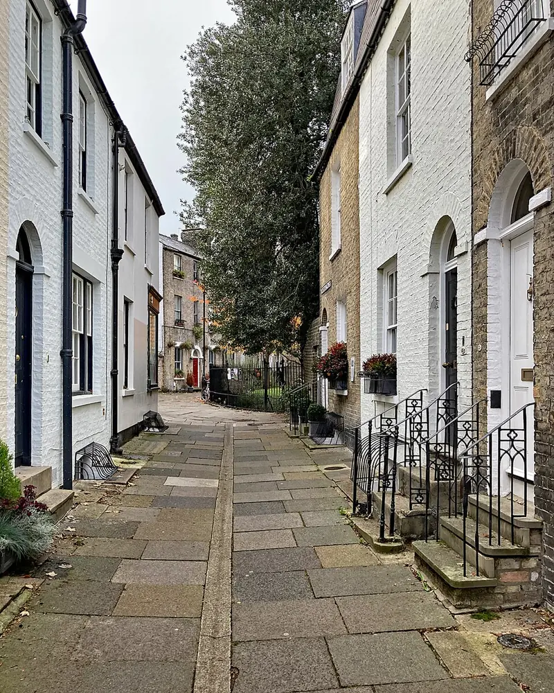
Portugal Place in Cambridge, looking towards Bridge Street on an autumn morning
Real Portugal Place photograph, 16 November 2022: John Sutton / Wikimedia Commons · CC BY-SA 2.0. The image may be scaled for display; it is not a Ludwig still.
Screen evidenceNamed in a published Episode 3 street-location report; exact shot and scene details unverified
WherePortugal Place, between Bridge Street and Park Street, central Cambridge
VisitPublic street · no ticket or venue booking
What to look for

A short historic lane

Portugal Place turns off Bridge Street near St Clement’s Church and continues towards Park Street. Greater Cambridge’s historic-core appraisal documents the street’s buildings and townscape; this is a lived-in street, not a visitor attraction. Patrick Comerford names Portugal Place among the central Cambridge streets appearing in Series 2 Episode 3. That report does not identify a camera position or prove every view along the lane was used.

Return to the Episode 3 guide →

Before visiting · checked 20 September 2026

Walk it respectfully

The photographed viewpoint is a visitor reference, not a verified production camera mark.

Series 2 · Episode 3 · reported square

Market Hill: the real market square

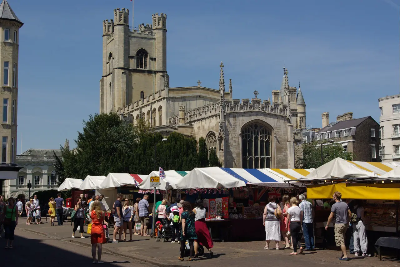
Cambridge Market Square with market stalls and Great St Mary’s Church in a photograph from 2012
Real Market Hill photograph, 27 May 2012: Stephen McKay / Wikimedia Commons · CC BY-SA 2.0. Market stalls and surrounding streets may look different now.
Screen evidenceNamed in a published Episode 3 street-location report; exact shot and scene details unverified
WhereMarket Hill, Cambridge CB1 0SS
VisitPublic square · market usually 10am–4pm
Before visiting · checked 20 September 2026

Plan a market stop

  • Access and cost: Market Hill is a public square; no ticket is needed to see it. Shopping, food and adjoining buildings have separate costs and access.
  • Hours: Cambridge City Council lists the market as 10am–4pm every day except Christmas Day, Boxing Day and New Year’s Day. The open square and the staffed market are different things.
  • Getting there: Walk from central Cambridge. The council lists Grand Arcade as the closest car park and also recommends city-centre buses or Park & Ride; check current routes and charges.
  • Changing conditions: The council has Market Square redevelopment proposals. Check its current market page before travelling for any temporary stall or access changes.
  • Access on the ground: This is a busy trading area. Keep stall approaches clear and check current surface and step-free routes before travel if needed.

The 2012 photograph is a historical visitor reference, not a verified production camera mark.

Series 2 · Episode 3 · reported street

Trinity Lane: the college-quarter route

Trinity Lane in Cambridge, looking along the college buildings in a 2012 photograph
Real Trinity Lane photograph, 27 May 2012: Stephen McKay / Wikimedia Commons · CC BY-SA 2.0.
Screen evidenceNamed in a published Episode 3 street-location report; precise shot unverified
WhereTrinity Lane, central Cambridge, near Trinity Street and Garret Hostel Lane
VisitPublic lane · college buildings have separate access rules
Before visiting · checked 20 September 2026

Use the public lane

  • Access and cost: Walking along the public lane needs no ticket; entrance to Trinity College, Trinity Hall and other buildings is separate.
  • Finding it: Trinity Hall’s directions place the lane between Trinity Street, Senate House Passage and Garret Hostel Lane. The Hall’s visitor map identifies its entrance and private areas.
  • College access: Trinity College says its courts are not normally open to the public. Check any college’s current visitor rules independently; a street view does not grant entry.
  • Getting there and comfort: Walk from central Cambridge. Trinity College estimates about ten minutes from the Drummer Street bus station. This is a narrow working route shared with other pedestrians and cycles; check current surfaces and a suitable step-free route before travel.

The photographed view is a visitor reference, not a verified production camera mark.

Series 2 · Episode 3 · reported bridge

Garret Hostel Bridge: cross the Cam

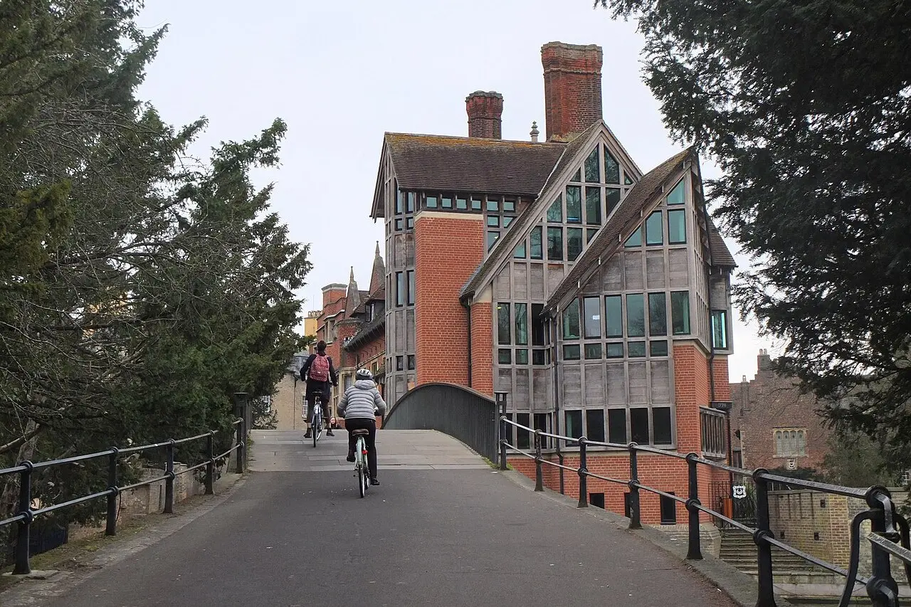
The rising public route over Garret Hostel Bridge beside Trinity Hall, photographed in 2019
Real Garret Hostel Bridge photograph, 21 February 2019: Jim Barton / Wikimedia Commons · CC BY-SA 2.0.
Screen evidenceReported among Episode 3 street scenes; exact bridge shot and scene details unverified
WhereGarret Hostel Lane, River Cam, Cambridge CB2 1TJ
VisitPublic crossing · adjoining college grounds follow their own rules
Before visiting · checked 20 September 2026

Cross without entering private grounds

  • Access and cost: The Discovering Britain walking trail describes a public right of way across this bridge. There is no bridge admission charge.
  • Finding it: The trail starts at Garret Hostel Bridge on Garret Hostel Lane, CB2 1TJ. Walk from the Trinity Lane side or approach from the Backs via the public route; use a current map before setting out.
  • Nearby college land: Trinity College says its Backs are normally open 9am–5pm but may close for events. That rule is for its grounds, not for the public bridge; check with the college before planning a detour inside.
  • On the crossing: The bridge rises towards its centre and is used by walkers and cyclists. Check the gradient and your step-free route in advance if relevant, and keep the passage clear when taking photographs.

The photograph shows a real approach to the bridge; it is not evidence of the production camera position.

Screen place

Is Scholars Fountain a real Cambridge location?

Within Ludwig, Scholars Fountain is presented as part of Cambridge. The Casebook has not found a production source establishing it as the name of a real Cambridge site, so it should not be treated as a visitor destination under that name.

Real-world comparison · not production-confirmed

The St Dunstan in the East suggestion

Viewer comparisons point to the ruined church garden of St Dunstan in the East in the City of London. That visual match remains a reported identification, not a confirmed production record. This distinction also explains why the programme’s Cambridge story geography cannot always be followed as one real walking route.

Return to the complete filming-location guide →

Cambridge filming: streets and screen names

Varsity’s report of 17 September 2025 records promotional photographs of Mitchell in All Saints’ Passage on 5 September, crew vans on Trinity Lane, and a camera crane and Steadicam equipment on Botolph Lane. The passage photographs were promotional work; these observations do not identify an episode scene for every street. Source.

Varsity’s 8 December 2024 account notes that Silver Street became Mallard’s Way on screen and a Queens’ accommodation block represented a development. The fictional street name should not replace the real street name in a visitor route. Source.

Casebook index

Search the archive

224 results