Ludwig Cambridge Filming Locations Walking Tour
Follow the Casebook’s self-guided Cambridge route to see the college, bridge and riverside locations used by Ludwig. The guide gives approximate walking times, access notes and links to the filming atlas.
Stop-by-stop Cambridge route
This self-guided circuit is designed as a walking companion rather than a claim that every exterior appears in one episode. Allow three to four hours without admissions, longer if you enter a college or stop for lunch. The central pavements can be crowded and several surfaces are cobbled or uneven. Distances are approximate; use signed crossings, respect college closures and check venue access on the day.
1. Cambridge railway station and Station Road
Screen connection: the station approach belongs to the wider Cambridge location language used across the programme rather than a single confirmed murder scene. Start beneath the main station clock, where the broad view down Station Road gives a useful contrast with the enclosed lanes later in the walk. The best photograph is from the pedestrianised forecourt, keeping clear of cycle flows. Toilets, refreshments and step-free facilities are available in the station; cafés line Station Square. Continue towards the city centre by Hills Road and Regent Street, about 22 minutes on foot. The route is mostly level, with controlled crossings, but it is busy.
2. Parker’s Piece and central Cambridge
Screen connection: city transitions and establishing views across Series 1 and Series 2 use the recognisable central Cambridge setting; the episode dossiers distinguish confirmed addresses from general views. From the south-east corner of Parker’s Piece, look diagonally across the open common towards the city skyline. This wide prospect is the best viewpoint and does not require stepping onto sports pitches. Public toilets are available near the city centre, and cafés cluster around Regent Street. Cross towards Emmanuel Street and continue to the Guildhall/Market Square area, roughly 12 minutes. Paths are paved and generally level, though temporary events may divert walkers.
3. Market Square and the Guildhall
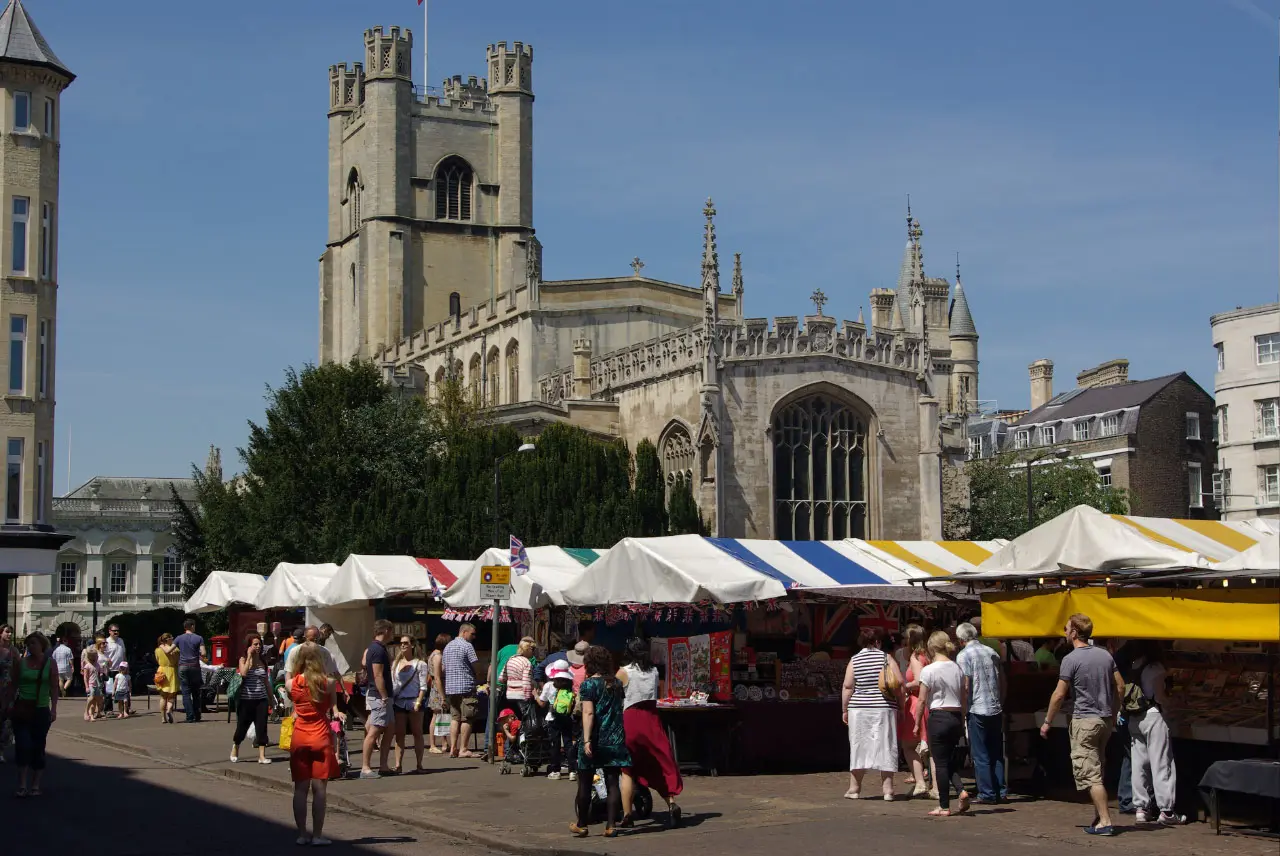

Screen connection: the civic centre supports the programme’s recurring police-and-newspaper Cambridge geography; check the linked episode and production maps for shot-level attributions. The market is best seen from the Guildhall side, where stalls, Great St Mary’s tower and the surrounding façades can share one frame. It is a working market, so do not block traders or photograph people at close range without permission. Market cafés and food stalls provide the easiest refreshment stop; public toilets are available in the Grand Arcade nearby. From here take Senate House Passage towards King’s Parade, approximately five minutes. The passage is narrow and can be difficult at peak times for wheelchair users or anyone who needs more space.
4. King’s Parade and Senate House Passage
Screen connection: these streets contribute to the series’ instantly readable Cambridge exteriors, particularly transitions around the historic centre. The strongest viewpoint is from the broad pavement opposite King’s College, looking north without standing in the cycle lane. The façades work best in early morning light, before tour groups fill the pavement. Numerous cafés have customer toilets, while public facilities are better found back near the market. Follow King’s Parade north, turn through the signed pedestrian route towards Queens’ Lane and allow eight minutes. Dropped kerbs exist, but cobbles, service traffic and dense crowds can complicate access.
5. Queens’ Lane
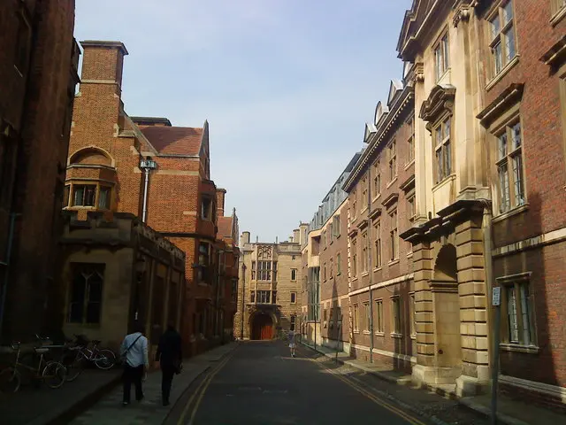

Episode: Series 1 Episode 1 uses Queens’ Lane in the opening journey that brings John into Cambridge. Its tight walls and bends turn an ordinary arrival into a visual puzzle, withholding the wider city until the lane opens. The best viewpoint is from the wider southern end looking into the curve; remain on the pavement and avoid recreating shots from the carriageway. The lane has no public toilet and little room to pause, so use facilities around King’s Parade first. Walk south towards Silver Street in about six minutes. The surface is uneven in places and the pavement narrows severely; visitors who need a smoother alternative can return via King’s Parade and Trumpington Street.
6. Silver Street and the Mathematical Bridge
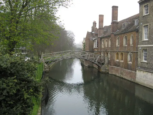

Episode: Series 1 Episode 3’s walking-tour story is the clearest narrative match for the visitor-facing Cambridge route, and the Silver Street/Queens’ College area belongs to its location cluster. The public bridge over the Cam offers the reliable view of the Mathematical Bridge; college entry is not required for that angle. Stand on the upstream pavement and keep moving if the crossing is crowded. Cafés are available on Silver Street and around Mill Lane. Public toilets are not guaranteed inside colleges, so use signed city facilities. The next stop, the Backs viewpoint, is around ten minutes via Queens’ Road. Silver Street is level but busy, and bridge pavements are constrained.
7. The Backs and river viewpoints
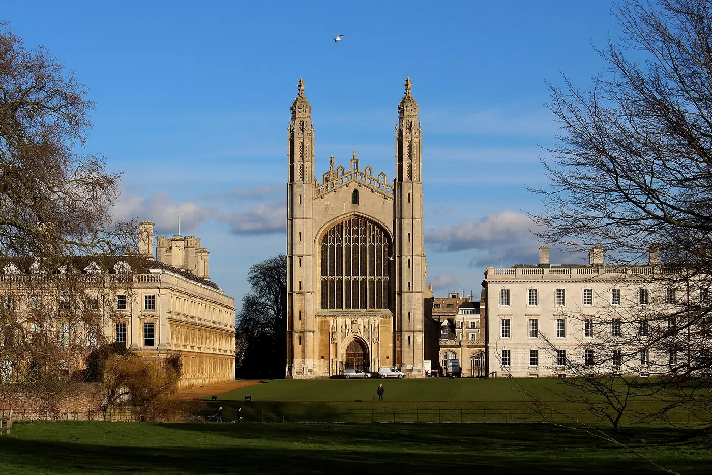

Screen connection: river and college views recur as geographical punctuation across both series, while individual building claims remain in their location dossiers. The best free prospect is from public paths and bridges, not private college lawns. Look across the water towards the rear elevations and keep towpaths clear for residents, runners and cyclists. Seasonal ground can be muddy. A café stop is easiest before leaving Silver Street; facilities on the Backs are limited. Continue north towards Garret Hostel Lane and Trinity Lane, about 12 minutes. Some riverside alternatives include steps, so wheelchair users should remain on signed street routes.
8. Trinity Lane and St John’s Street
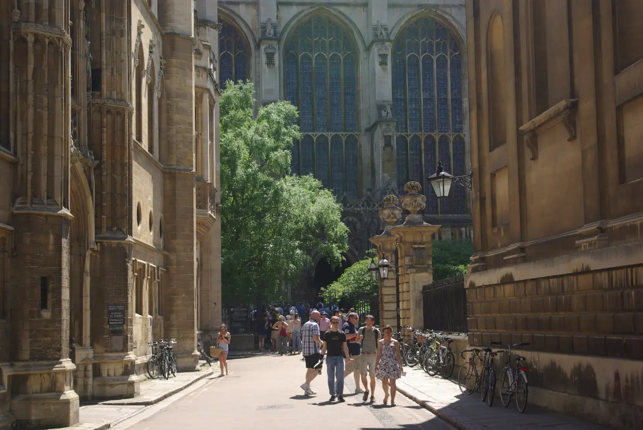

Screen connection: narrow college lanes reinforce the programme’s visual contrast between ancient institutions and contemporary police work. From Trinity Lane, frame the receding stone façades rather than doorways used by staff and students. This is a passage, not a viewing platform, and cycles can approach quietly. Cafés and accessible toilets are available in the commercial streets east of the colleges. Walk to St John’s Great Gate in approximately eight minutes. The route is paved but includes camber, old stone and pinch points; a companion may be helpful at busy times.
9. St John’s College and the Bridge of Sighs
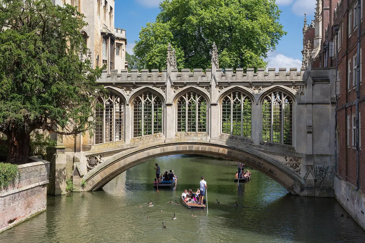

Screen connection: St John’s and the Bridge of Sighs are reported within the programme’s Cambridge production footprint, although not every appearance can be assigned confidently to a numbered episode. The famous bridge lies inside a working college. If visitor admission is open, follow the official route; otherwise an authorised punt can provide a river view. The strongest public-facing view is determined by the college route, not by crossing barriers. Check the college’s current visitor and accessibility page before travel. Toilets may be available to admitted visitors, subject to opening arrangements. Nearby cafés are plentiful on Bridge Street. The final stop at Jesus Green takes about ten minutes.
10. Jesus Green and the River Cam
Screen connection: this final open landscape complements the denser central locations used throughout the series and makes a practical end point rather than a claimed scene recreation. From the riverside path, look south-west along the Cam for punts, trees and college rooflines. Public toilets and seasonal kiosks serve the green, while Bridge Street offers year-round cafés. Surfaces are generally level, but grass can become waterlogged and some river edges are unprotected. Cambridge North and the main station require onward travel; consult live bus information rather than assuming a walk back will suit every visitor.
Practical choices before you set out
Short version: begin at Market Square, follow King’s Parade, Queens’ Lane and Silver Street, then finish at St John’s. This removes the long station approach and covers the most distinctive architecture in roughly ninety minutes without admissions. Step-free emphasis: stay on the principal streets, avoid narrow riverside shortcuts and confirm lifts, toilets and college routes directly with each venue. Quietest time: weekday mornings outside graduation periods are usually easier, but university ceremonies, filming and maintenance can close spaces without much notice.
The route is deliberately independent and unofficial. It does not grant access to sets, college interiors, private homes or production areas. Treat every stop as a living workplace or neighbourhood, and use the location dossiers for source links, current admission information and the distinction between confirmed filming, reported filming and general Cambridge atmosphere.
Filming notes along the route
At the Silver Street stop, distinguish the real street name from its screen name, Mallard’s Way. A Queens’ accommodation block also stood in for a development. Source.
Near the Trinity Lane and St John’s Street stop, All Saints’ Passage is an optional short detour: Varsity recorded promotional photography there on 5 September 2025 and crew vans on Trinity Lane. These are production observations, rather than a claim that the passage represents a particular case location. Source.
For a Botolph Lane detour, use the southern end of the central route near Trumpington Street before continuing towards Queens’ Lane and Silver Street. Varsity reported a crane and Steadicam there during the Series 2 shoot. Return to the signed public route rather than entering college accommodation. Source.
Stay near the filming locations
Prefer a guided Ludwig tour?
Brit Movie Tours plans to launch a guided, two-hour Ludwig walking tour of Cambridge from 2027. It is an option for readers who prefer a guide; check the operator’s page for launch dates and booking details.